High Paying US Jobs, Economic Empowerment & Revitalization of States through Federal Power |
"Critical Field" Technology Innovation & Maximized Profits on R&D and Investments |
Prevention of Biochemical and Nuclear Proliferation & Homeland Security Technologies |
International Council on Innovative Technology Commercialization |
|||
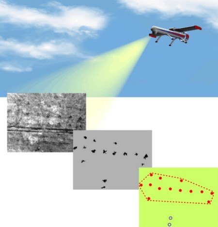
When resolving problems of detecting mine fields using data obtained from airborne vehicles: aircraft, helicopters and unmanned aerial vehicles (UAV), processing can be split into a number of stages, see picture. The image of a terrain section under investigation obtained by a sensor is transformed into a digital form and is introduced into the computer. Then preliminary processing takes place to identify small-size objects (mines) and form binary images. At the final stage they resolve the tasks of identification and decision making on the existence of mine and mine fields on the terrain segment under investigation. A specific feature of this task is that following preliminary processing of images received by a sensor it is necessary to identify small-size objects on various type underlying surfaces, brightness characteristics thereof varying in a rather wide range.